Plum Creek Drainage Study
Hutchinson, KS
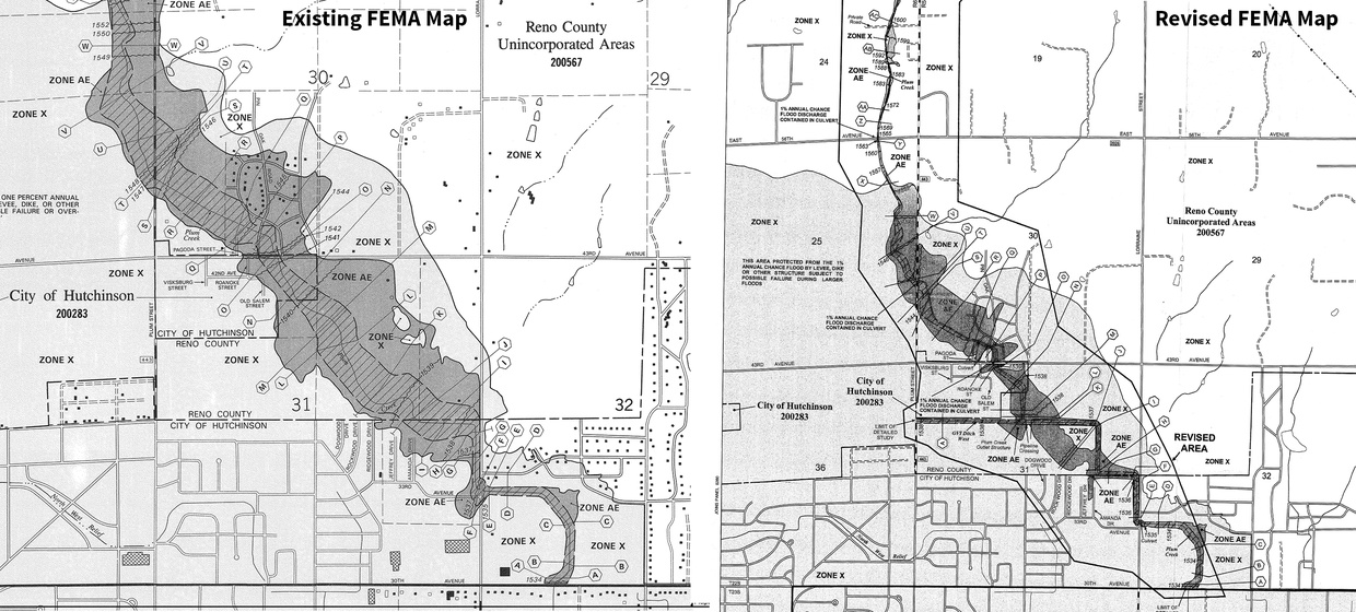
In northwest Hutchinson, an existing FEMA map designated much of the area within the floodplain. A floodplain is the area determined to be subject to a 1% (100-year) or greater chance of flooding in any given year. BG Consultants was retained to aid in the pursuit of removing properties from the floodplain on FEMA maps.
The area under consideration was predominantly sand hills, and the original floodplain study had been very conservative in estimated flows. BG Consultants performed a HEC-HMS and HEC-RAS study of the basin and identified a substantially modified area impacted by the 1% occurrence storm events. BG facilitated public meetings with affected landowners to successfully move the project forward. At the end of 2007, the models were submitted to FEMA. In October of 2008, FEMA accepted the models and revised the flood plain map for Plum Creek. This allowed a substantial number of homes to be removed from a designated flood zone, without any significant construction efforts.
After reviewing the revised floodplain maps, the City of Hutchinson opted not to proceed with a previously considered $575,000 detention basin project.
